Hiking does not always mean heavy backpacks, rafting on wild rivers and walking until exhaustion. We are sharing a selection of national and natural parks of the Urals, where you can comfortably wander along forest paths, breathe clean air, admire the stars and panoramic views of mountain ranges.
“Deer Streams”
Find drawings of ancient people and climb into the cave
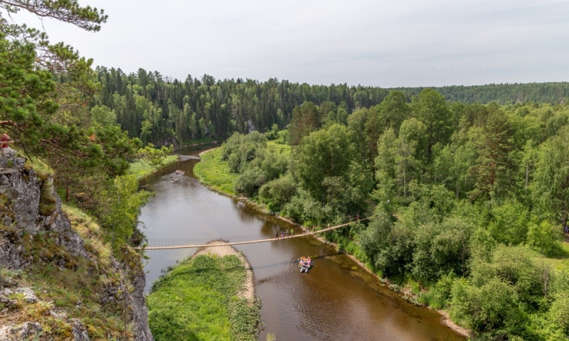
The natural park 120 km from Yekaterinburg is famous for rock carvings more than 3,000 years old. Pisanitsa (or written stones) in the Urals are called ancient drawings: thousands of years ago, hunters from Finno-Ugric tribes used natural pigments to paint animals, birds, humanoid creatures and geometric patterns on coastal rocks. It’s more convenient to view images from the water: for example, from a kayak or catamaran.
Tourists come here to admire the arch of the karst bridge, walk through a narrow crevice between seemingly kissing stones and explore the mysterious underground world. In a remote corner of the park there is the Druzhba Cave, the largest in the Middle Urals. The length of its passages, according to various estimates, ranges from 500 to 1,000 m. Without special equipment, you can explore the first three grottoes – this is enough to see bizarre stalagmites, stalactites and bats, freeze and miss the sunlight.
The park has excursion routes ranging from 6 to 15 km in length, there are gazebos and parking areas – you can spend the night at the cordon or in your own tent. “Oleniye Ruchi” is also popular as a location for water activities: rafting and SUP boarding.
How to get there
By plane to Yekaterinburg. It is convenient to get from the city to the national park by car.
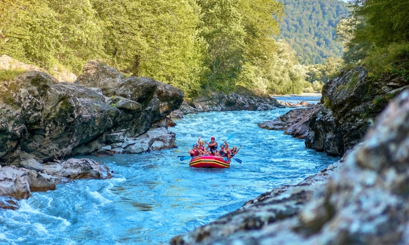
“Chusovaya River”
Raft along the route of the iron caravans
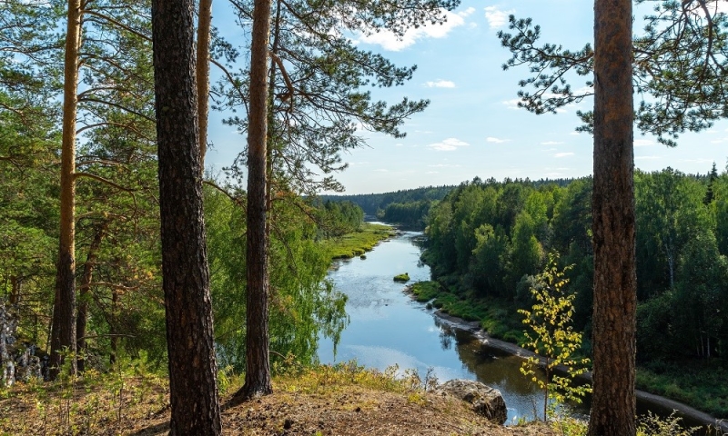
The Chusovaya River Natural Park is based on the water route of the legendary “iron caravans”. From the beginning of the 18th century until the revolution, the products of the Ural ironworks were delivered to central Russia by water, and Chusovaya was one of the few rivers crossing the Ural ridge. Heavily loaded barges were sent in the spring, immediately after the ice drift, when the water level in Chusovaya rose. On the way, the raftsmen were in wait for numerous fighting stones – beautiful, but dangerous coastal rocks for the caravan, past which they had to contrive to navigate the clumsy ships.
In Soviet times, tourist route No. 58 passed along the waterway of the “iron caravans,” the markings of which are still used today. You can go sailing on a kayak, kayak, catamaran or stand-up paddle board. The main attractions of the park are three hundred coastal rocks, from small to formidable king-fighters. For example, the height of the Giant stone in front of the village of Kyn is 120 m, and its length is almost one and a half kilometers. The rafting will be diversified by several caves left after the filming of the films “Gloomy River”, as well as scenery and monuments of industrial culture of the mining and processing Urals: the remains of the Demidov pier in Ust-Utka, the equestrian statue of Akinfiy Demidov in the village of Starye Kharenki and the open-air museum in the village of Sulem.
The total length of the route from Kourovka station in the Sverdlovsk region to the city of Chusovoy in the Perm region is about 350 km. You can swim an interesting section over the weekend, walk part of the way, go on a family rafting trip for a week, or gather your strength and raft the entire route. There are designated and wild campsites along the way, and it’s easy to replenish your food supply in the village shops. Also in the park and its surroundings you can go rock climbing, ride bicycles along the river or go camping.
How to get there
By plane to Yekaterinburg. It is convenient to get from the city to the national park by car.
“Bazhov places”
Find the forest heart and escape from Sinyushka
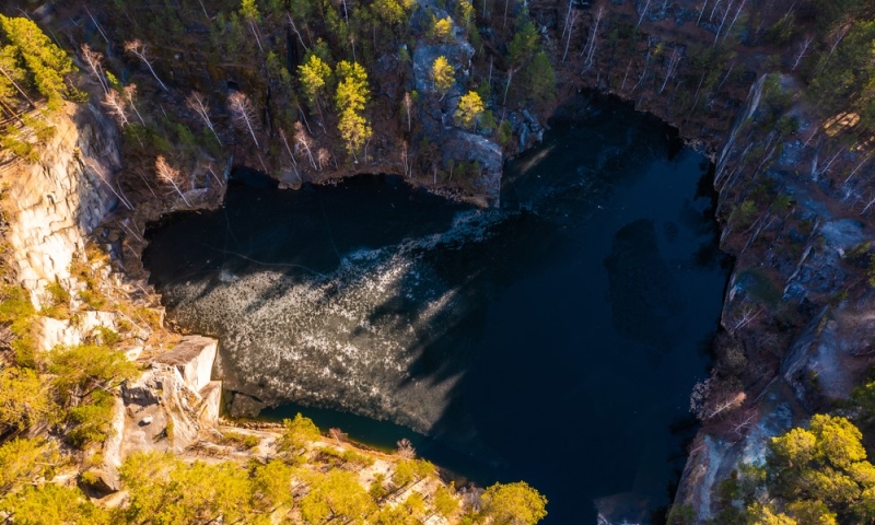
A small cozy park 50 km from the capital of the Urals near Sysert. The main natural attraction of the “Bazhov Places” is Lake Talkov Stone with water ranging from greenish to deep blue, surrounded by steep cliffs. This is a former quarry: until the beginning of the 20th century, until groundwater began to fill the mine, talc was mined here. The lake is especially beautiful in late autumn: imagine a heart-shaped emerald cut in gold – this is exactly what Talkov Stone looks like from a bird’s eye view. The acoustics here are like in a good concert hall: try playing your favorite melody and listen to how the sound reflects off the rocks.
On the shores of the lake there are gazebos and forest houses, where it is pleasant to drink tea after a walk in the forest. Only daredevils swim here: the bottom of stone slabs plunges sharply into the depths, there are cold springs, and visibility due to fallen trees and the smallest suspension of talc is very low.
The charm of the park is given by the legends of the mining Urals and the tales of Pavel Bazhov – the writer was born in neighboring Sysert. Sculptures of the heroes of his works can be found along the trail: from the harmless Golden Snake to the impressive grandmother Sinyushka, even for adults, who effectively reaches out her hands to passing tourists. Routes from 2.5 to 11 km are marked: along the way you will see beaver dams, a model of an iron-making furnace, the Boiling Spring and a feeding trough for roe deer. We recommend continuing your acquaintance with Bazhov’s world in Sysert: stop by the writer’s museum and stroll along the restored embankment overlooking the city pond.
How to get there
By plane to Yekaterinburg. It is convenient to get from the city to the national park by car.
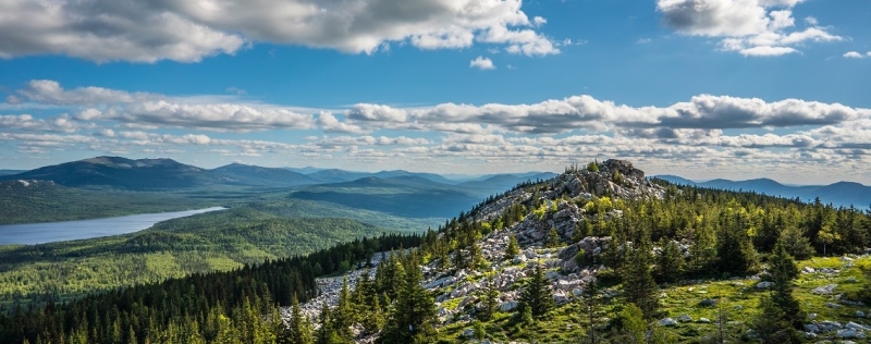
“Taganay”
Climb higher and see the stone river
One of the main tourist brands of the Southern Urals, Taganay National Park, is visited by about 235,000 people a year. The secret of such attractiveness is in the stunning mountain landscapes and well-thought-out infrastructure of the park: all the trails are marked, information boards are installed, you can comfortably spend the night in shelters and cordons even with small children, as well as take a steam bath.
Hiking enthusiasts from all over the country come here to see with their own eyes the Big Stone River – the largest scattering of cobblestones in the world, climb the Dvuglavaya Sopka and Kruglitsa, wake up the echo on the Otklikny Ridge and watch the sunrise on the Dalny Taganay plateau. From the window of the most remote shelter of the park, the Meteorological Station, if circumstances are lucky, you can watch lynxes or wolves in their natural habitat, and foxes often come to the nearby parking lot of the White Key.
The park offers routes ranging from short kilometer-long routes lasting a couple of hours to multi-day routes up to 65 km long. In addition to hiking, you can go trail running or, if you have experience in this type of riding, ride a mountain bike along forest paths with rocks and streams.
How to get there
By plane to Chelyabinsk. It is convenient to get from the city to the national park by car.
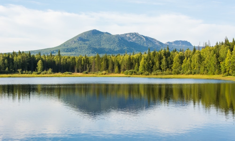
“Zyuratkul” and Iremel
Make a wish and meet a moose
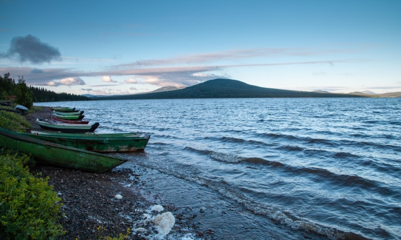
It is convenient to combine a hike through the Zyuratkul National Park in the Southern Urals with an ascent to Mount Iremel. Lake Zyuratkul and the village of Tyuluk, from where the routes to the second highest peak in the region start, are separated by a little more than 60 km. The trail begins on the shore of a clear reservoir, passes through the deep taiga, the spurs of the Nurgush ridge and Mount Uvan, and then descends to Tyulyuk. Along the way, we advise you to relax at the “At the Three Peaks” cordon: sleep in a house or your tent and visit the moose at the “Sokhatka” rehabilitation center. On clear August nights, from the ridges and peaks of the park you can watch the Perseid meteor shower, make wishes on falling stars, or photograph the Milky Way without leaving your tent.
From Tyulyuk, along a more popular path, go to the top of Iremel – this is the second highest mountain in the Southern Urals, accessible to tourists. Among the local population, it has long been considered sacred and inaccessible to people with unclean thoughts. The upper path goes through the forest, gradually reaches a plateau and ends at a kurumnik – a pile of large living stones. It is convenient to return to the village along the shorter lower path. The circular route is approximately 26 km.
In addition to hikers, you can often meet mountain runners and cyclists on Iremel, who are attracted by panoramic views and interesting mountain terrain.
How to get there
By plane to Chelyabinsk. It is convenient to get from the city to the national park by car.
Useful tips
- Don’t forget about vaccination against tick-borne encephalitis and health insurance.
- Go rafting in the first half of summer: by August the Ural rivers become very shallow – in some places the water barely reaches your ankle.
- Book your places in the houses on the cordons and in the shelters in advance: before the holidays and on summer weekends they are sold out a month in advance.
- Stock up on cash: due to unstable connections, it is not always possible to pay for a visit to the park with a bank card. Ticket prices range from 100 to 430 rubles* per person, additional services (accommodation in houses, sauna, equipment drop-off) are paid additionally.
- Before setting out on the route, check the forecast and be prepared for sudden changes in weather: it is unstable in the mountains.
*Prices are current at the time of publication.