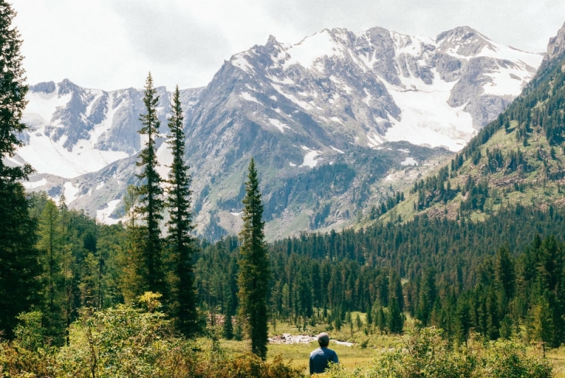
They say that the best vacation is a change of activity, which is why residents of big cities often escape on vacation somewhere closer to nature, where it is quiet, calm, you feel closer to the earth and enjoy real space, when, No matter where you turn, your gaze goes to the infinitely distant horizon. For those who love such a vacation, we have compiled a selection of ten amazing places for active travel in Russia.
1. Marble Canyon Ruskeala (Karelia)
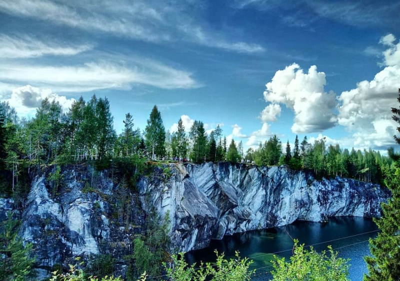
Photo: @namratasha/Instagram.com
The canyon in the Ruskeala mountain park was formed about two centuries ago, when, on the orders of Catherine, marble began to be mined here to decorate the palaces and cathedrals of St. Petersburg under construction. In the 19th century, the development was abandoned, and the quarry was flooded with crystal clear mountain water of an incredibly emerald hue, which now reflects the majestic trees and vertical marble walls of the canyon. A path strewn with marble chips winds along the edge of the gorge, and along it there are observation platforms. If you go on a boat trip, you can go into one of the caves and even scuba dive – the water is absolutely transparent, you can see through it to a depth of almost 20 meters.
How to get there: train St. Petersburg – Sortavala from 452 rubles
Accommodation: from 900 rubles per day per person
2. Museum-reserve “Divnogorye” (Voronezh region)
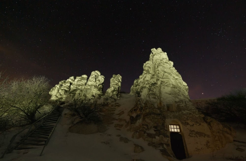
Photo: Olga Kurguzova/Shutterstock
The main attraction of the Voronezh region – Divnogorye – is a vivid example of how harmonious the union of nature and man can be; it is not for nothing that this museum-reserve preserves natural, architectural, and archaeological values. The high chalk mountains have been partially preserved untouched, and partially have been developed by man: long passages have been dug inside, leading to cave churches of the 19th century. On the walls of the caves you can still find small brown lumps – dried traces of algae from the ocean that once covered this land. Tall chalk pillars, which are called “Divas” here, and the whitewashed walls of the monastery with golden domes shine brightly in the sun, and from the top of the mountain a panoramic view of the surrounding steppes opens up that will take your breath away.
How to get there: train Voronezh – Liski from 562 rubles. Next, transfer to one of the trains along the route “Liski-Alekseevka” or “Liski-Ostrogozhsk” and go to the stop “Stopping platform 143 km”.
Accommodation: from 500 rubles per day per person
3. Sarai-Batu Palace (Astrakhan region)
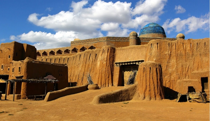
Photo: Evgeny Fateev/photosight.ru
A trip deep into the Astrakhan steppe is like traveling back in time: the Sarai-Batu Museum is a carefully restored city from the times of the Golden Horde, which stood on the steep banks of Akhtuba and was destroyed by Tamerlane in the 14th century. Sarai-Batu was once the capital of the Golden Horde Khanate, the pearl of the Silk Road, where a majestic palace rises above clay houses, shopping streets and the city square. The reconstruction of the city began in 2011 for the set of the film “The Horde”, and it was done so well that upon completion of filming they turned this place into an open-air museum, where historical festivals and theatrical performances now regularly take place.
How to get there: the cultural and historical center of Sarai-Batu is located 130 kilometers from Astrakhan. You can get there by car along the Astrakhan – Volgograd highway.
4. Romantsevskie Mountains (Tula region)
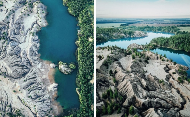
Photo: @xandr.o/Instagram.com
In the Tula region, in the village of Konduki, there is one unusual place, completely uncharacteristic of the local terrain – the Romantsevskie Mountains. Fifty years ago, brown coal was mined here, the deposits of which came close to the surface of the earth. Gradually, the amount of coal in the ground decreased, water began to accumulate in the quarries, and mining it became increasingly unprofitable. In the early 90s, work was stopped. Over time, the quarries were flooded even more and lakes formed at the excavation site, each with its own shade – from turquoise to deep blue, depending on the amount of minerals dissolved in the water.
How to get there: From Tula you can get to the village of Konduki by car, the distance is only 85 kilometers. The distance from Moscow to the quarries is 360 kilometers and can be reached on the M-4 highway in 3.5 hours. Or at Paveletsky station take a train or commuter train and go to Zhdanka station, where you change to a bus to Konduki.
5. Natural Park “Oleniy Ruchi” (Sverdlovsk region)
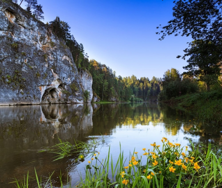
Photo: © Dmitry Ilyshev (ilyshev.photo)
“Deer Creeks” owes its name and symbol to ancient rock paintings discovered on the sheer cliff walls just above the water. The territory of the park extends for many kilometers on the border of two landscape zones – mountain taiga and forest-steppe, so the nature here is very diverse – green forests, rocks with grottoes and caves, lakes of flooded mines and the cleanest Serga River. Tourists can follow a walking route or raft down the river, look into a deep hole, at the bottom of which there is ice all year round, and take fabulous photos with the arch of the Drinking Horse rock undermined by the river.
How to get there: “Oleniye Ruchi” is located 120 kilometers from Yekaterinburg. You can get there by car, leaving Yekaterinburg towards Perm.
6. Arakul shihans (Chelyabinsk region)
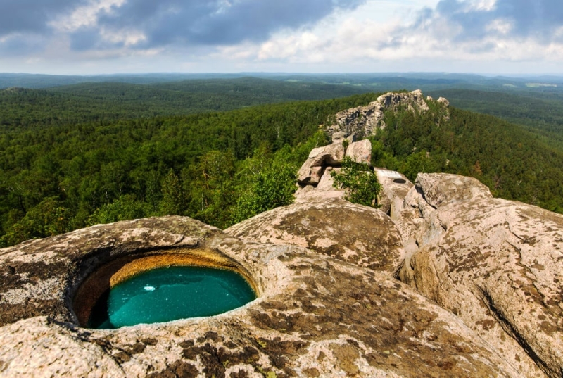
Photo: © PolTergeist/photosight.ru
The Arakul Shikhany rock mass is a narrow mountain range stretching two kilometers in length. In appearance, Shikhan looks like the Great Wall of China, only it was made not by man, but by nature itself – by the forces of winds and rains, streaking the rock with longitudinal lines reminiscent of uneven brickwork. The rocks have natural bowls that fill with water. At sunrise and sunset, the sun paints the rocks in warm pink tones, and if you climb to the highest point, Chamberlain Peak, you will see 11 lakes, the largest and most beautiful of which is Lake Arakul with sapphire-colored water.
How to get there:train Ekaterinburg – Verkhniy Ufaley from 382 rubles. Next, take a bus or train to the village of Silach, and from there walk 4 kilometers to the rocks.
7. Katu-Yaryk pass (Altai Republic)
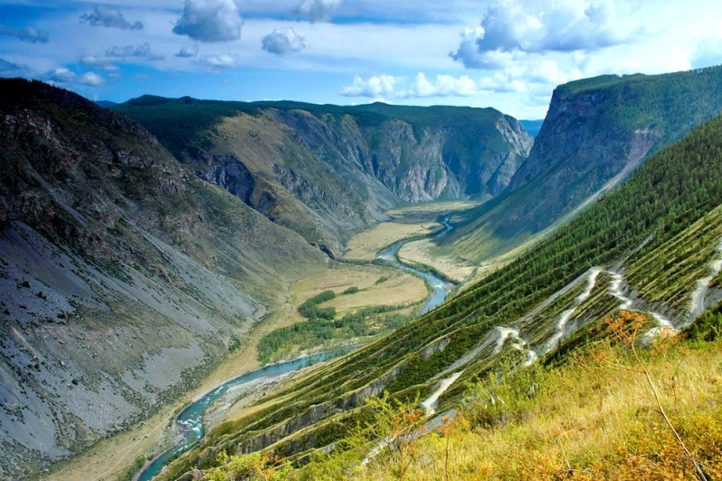
Photo: © Albert Belyaev/photosight.ru
One of the most picturesque, but at the same time the most difficult roads in the Altai Republic is the Katu-Yaryk pass, the descent from the Ulagan Highlands to the valley of the Chulyshman River. The serpentine with 9 sharp turns and a slope of 35° draws a line on the slope similar to a cardiogram; one can imagine that this is exactly how the heart of the great Altai beats. At the very beginning of the descent there is an observation deck from which a magnificent view of the majestic mountains and the river valley immersed in greenery opens. Alas, you can only go down in a tall all-wheel drive vehicle, and even then it’s quite risky, so there’s a tractor on duty at the beginning of the climb, just in case.
How to get there: by car from Biysk or Gorno-Altaisk along the P-256 highway. Location coordinates 50.910633, 88.222877.
8. Women’s monastery of St. John the Theologian of the Barnaul Znamensky Monastery (Altai Republic)
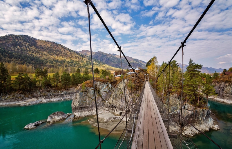
Photo: © lora_pavlova/photosight.ru
Legend has it that one day John the Theologian dreamed of two temples floating above the water – one in the warm waters of the Mediterranean Sea, and the other somewhere on the opposite end of the earth. The first temple stands on the Greek island of Patmos, and the second is in the Altai region, on a secluded island with the same name. The steep rocky shores of this island rise 35 meters above the Katun River, so the only way to get to it is to cross a picturesque suspension bridge stretched 15 meters above the fast waters of the mountain river. The bridge is wooden and quite long, so for safety reasons, groups of no more than six people are allowed onto it. The women’s monastery of St. John the Theologian is located on the island, but you don’t have to be religious to feel the special power and energy of this unique place.
How to get there:by car along the P-256 highway or by regular buses from Barnaul or Biysk to the village of Chemal.
9. Chara Sands (Trans-Baikal Territory)
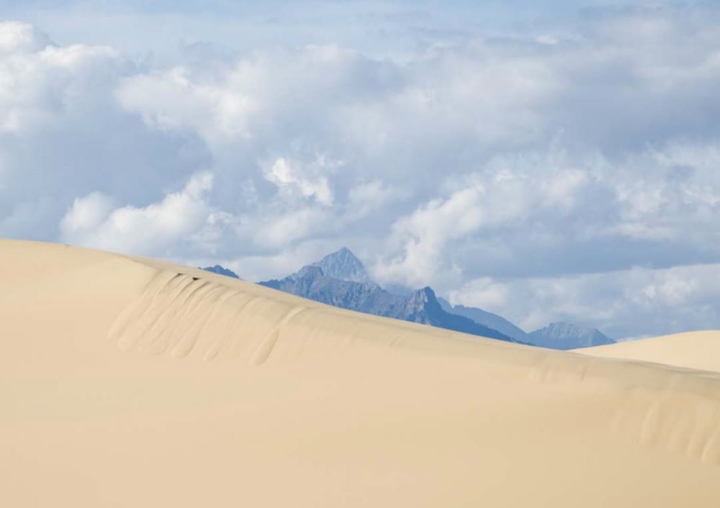
Photo: @rsbratsk/Instagram.com
On the northern border of the Trans-Baikal region, in a valley surrounded by mountains, there is a real miracle for the local climate – a sandy desert with sloping dunes covered with wind ripples, singing dunes and bare skeletons of trees that died from drought. The snow-capped mountain peaks on the horizon are fascinating and distinguish this miniature desert from others. There is also an oasis in this desert – two small lakes, Alyonushka and Taiga, near which grasses and shrubs with bright taiga flowers spread across the lifeless sands.
How to get there: train Chita – Novaya Chara from 5,844 rubles. Next, from the Novaya Chara station, take a regular bus and get to the village of Chara, from where you can walk another 5 kilometers or rent a car and drive there.
10. Gorely Volcano (Kamchatka)
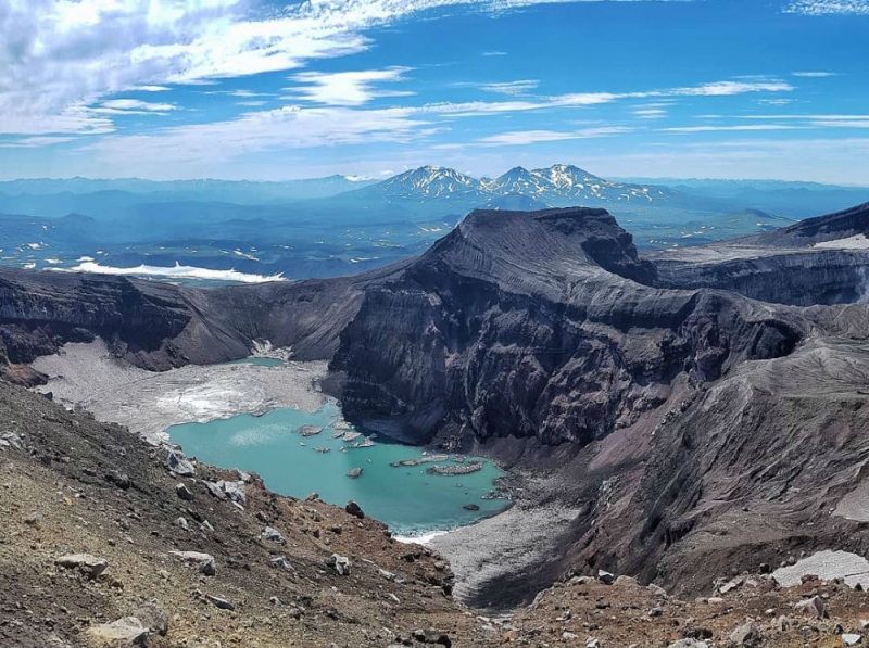
Photo: @alenkanov41rus/Instagram.com
Gorely Volcano is often called a ridge because of its elongated shape. It is somewhat lower than its neighbors, Mutnovsky and Vilyuchinsky volcanoes, and from the outside it does not look more attractive than them, but everything changes when you climb to its top. In the caldera of this volcano, several craters are lined up, each with its own characteristics and memorable landscape. The only active crater is called Active – it is the most impressive; in the depths of its crater there is an acidic lake of bright turquoise color, along the edges of which clouds of sulfur dioxide constantly rise. At the bottom of the largest crater there is also a cold Blue Lake with ice floes floating in it. Trekking to the ensemble of craters takes only a few hours, and the landscape at the top is completely surreal.
How to get there: by car along the P475 highway from Petropavlovsk-Kamchatsky.
You can find and book hotels on OneTwoTrip. The service offers more than two million accommodation properties worldwide.
Text author: Irina Krokhaleva

