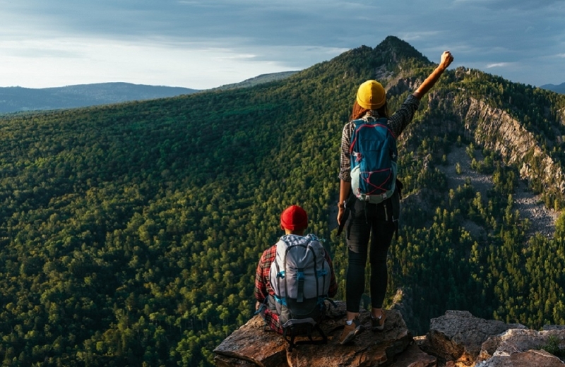
Go on an exciting walk to sort out your thoughts, hear the silence and remember your favorite poems. Repeat Brodsky’s lines in time with your steps, conquer the passes to the tunes of “Spleen” or simply admire the wonderful world of mountains and forests with wide open eyes.
Through the mountains to the Black Sea
How to get there
A plane ticket from Moscow to Sochi and back will cost an average of 11,000 rubles* per person . Then take a car or taxi to the starting point.
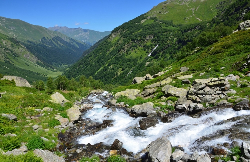
The new trail was created on the basis of the Soviet tourist route No. 30 “Through the mountains to the sea.” Thousands of people annually passed the legendary “Thirty” through the Caucasian Biosphere Reserve and the glacier at the foot of Mount Fisht. Now the route has been partially restored – it is 50 km of mountain trails, to which several more walking directions can be added if desired. Typically, the “Thirty” is completed in 4-7 days, depending on the pace of movement, the number of added attractions and the time spent contemplating the majestic mountains, alpine meadows, glaciers and rushing streams.
The path starts from the Lagonaki checkpoint and passes through the Fisht-Oshten massif through the Guzeripl and Armenian passes, then descends into a picturesque clearing to the Fisht shelter. There are lodges for tourists and amenities for those who prefer to live in their own tent. From here you can easily walk to the Small and Large Fishtinsky glaciers or Lake Psenodakh.
From the Fisht shelter the trail descends to the Babuk-Aul cordon and along the river through subtropical forests reaches the finishing point – the village of Solokh-Aul. From here, tourists return to the coast by bus or hitchhike.
To guarantee access to the reserve, check in advance the opening times of the routes. They are weather dependent and are usually available from mid-June until the first snowfall. It’s also convenient to pre-order a pass to visit the reserve on the website, the cost for children under 14 years old is 150 rubles*, for adults – 300 rubles*.
Great Baikal Trail
How to get there
A flight from Moscow to Irkutsk and back will cost an average of 16,000 rubles* per person. From the city to the village of Listvyanka it is 70 km, a bus runs several times a day.
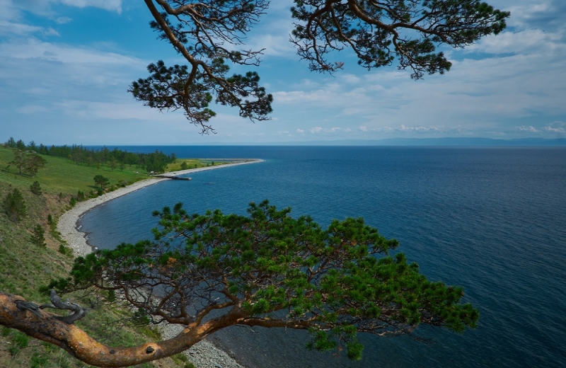
Don’t be upset if you didn’t have time to see the famous Baikal ice and hummocks. In late spring and summer it is also incredibly beautiful here, and the conditions are much more comfortable.
For almost two decades, specialists and volunteers have been working on the “Great Baikal Trail” project on the territory of the Pribaikalsky National Park. They develop hundreds of kilometers of eco-trails on the shores of the lake and take care of the ecology of the area. The trails are maintained safely and are accessible even to travelers with children. To visit the park you need to obtain a permit, the price is 150 rubles*.
One of the most beautiful and easy sections of the trail runs from Listvyanka to the village of Bolshoye Goloustnoye. The length of the route is about 55 km, and almost the entire section is located on the picturesque shore of Lake Baikal with wonderful views of the lake and forested hills. Pines and Red Book flowers, rocks, pebble beaches with clear water and open spaces to the horizon will be remembered for a long time. The trail leads through Cape Skriper and the Devil’s Bridge, descends into the valleys and again climbs the steep bank. Along the way, look into the Chapel Cave, where ancient people lived, and climb the Holy Mountain.
After finishing in the village of Bolshoye Goloustnoye, it’s interesting to explore the surrounding area: go to Dry Lake, arrange a photo hunt for roe deer in Ushkanya Pad, or admire the stalagnates in the galleries of the Hunter’s Cave.
To the foot of Belukha
How to get there
The most convenient way is to fly to Gorno-Altaisk; ticket prices from Moscow start from 18,000 rubles*. More budget-friendly, for an average of 12,500 rubles*, you can get there through Novosibirsk, taking a bus to Gorno-Altaisk, and then transfer to a minibus to the village of Tyungur.
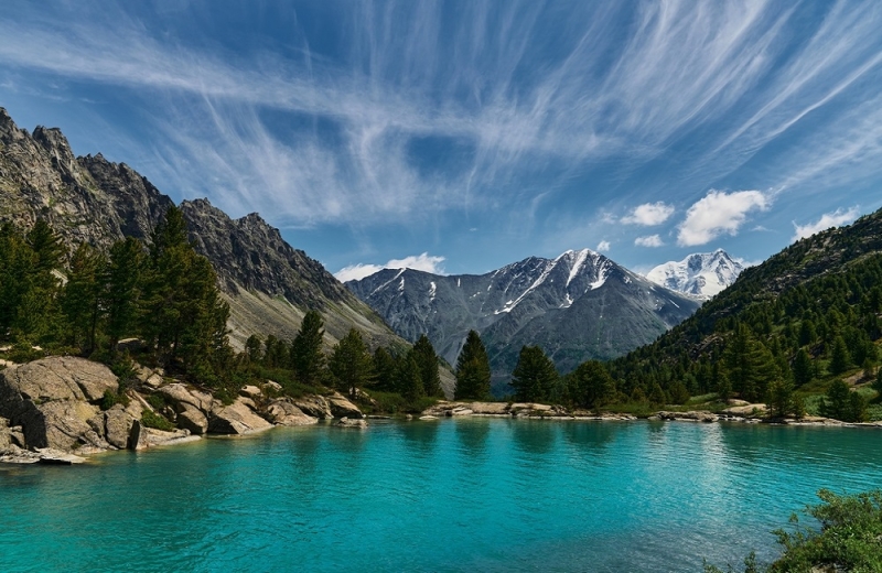
Trekking to the foot of Belukha in Altai is one of the most beautiful and popular in Russia. The majestic mountain, 4506 m high, crowns the picturesque Katunsky ridge, and at its foot lies the glacial Akkem Lake.
There are several options for approaches to the beautiful Belukha, the length of routes with radial exits varies from 37 to 80 km. Most of the trails are easy to read, so if you have GPS tracks, it’s difficult to get lost here.
Most often, tourists follow the simplest trail, Akkemskaya, from the village of Kucherla, 3.5 km from Tungur. You can get to the foot of the mountain near Lake Akkem in a couple of days, and the first 17 km of the road can be covered using a delivery truck. A more interesting and longer option is to follow the Kucherlinskaya trail, then you will see the turquoise lake of the same name and admire the view of Belukha from the Karaturek pass at a height of 3060 m.
The best option, if you have time and energy, is to climb along the Kucherlinskaya trail and descend along the Akkemskaya trail. This way you can loop the hike to see most of the local beauties. Meditating on the snow-white mountains at sunset, remember the paintings of Nicholas Roerich – he loved these places and captured them in numerous drawings.
Mountain sun of Dombay
How to get there
A plane ticket from the capital to Mineralnye Vody will cost an average of 7,500 rubles*. From the airport to the village it is 200 km, which can be traveled by taxi or bus.
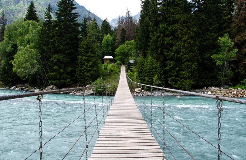
Dombay is well known to skiers. With the arrival of spring, the tourist season at the resort does not end, the format simply changes: instead of winter holiday lovers, those who adore mountain hiking come. They have plenty of places to roam – in the surrounding area there are several beautiful one-day routes ranging from 12 to 30 km, some of which pass through the territory of the Teberdinsky Nature Reserve. To visit it you need a ticket, the cost for adults is 200 rubles*.
Trekking in Dombay offers magnificent mountain views and at the same time a fairly comfortable stay. Here you can live in a hotel with all the amenities, dine in a cafe and go hiking along different routes every day. Wild gorges and blooming alpine meadows, snow-white peaks and rocky ridges, glaciers, turquoise lakes and incredible open spaces – it’s hard not to love Dombay. Tourists can see the majestic Belalakaya, which is called the Russian Matterhorn for its resemblance to the Swiss pyramid mountain, Sufrudzhinsky waterfalls, Alibek glacier, Baduk lakes and Mount Mussa-Achitara. It is convenient to climb the latter by lift and walk with fresh energy at the top. On a clear day you can see Elbrus from here.
One of the most memorable routes is the climb to the Krugozor lookout on the Semyonov-Bashi ridge. Relict fir trees give way to subalpine meadows, and behind them come scattered stones and snow. Already at the exit from the forest, breathtaking views of the peaks of the Main Caucasus Range, glaciers and flowering herbs open up. The length of the route is about 15 km with an elevation gain of 1500 m, depending on how high you are willing to climb in pursuit of beauty.
Great Valdai Trail
How to get there
Valdai is only 400 km from Moscow, you can get there by car or take a train ticket, cost starts from 1100 rubles*.
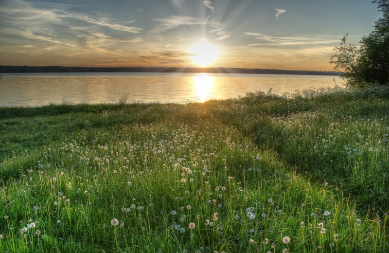
You won’t see mountain peaks, ancient glaciers or waterfalls on the Great Valdai Trail. People come here to listen to the sounds of the forest, admire almost a dozen lakes, eat wild berries and take a leisurely walk along well-groomed paths.
A simple route with a length of 59 km, which can be shortened if desired, is suitable for lovers of comfortable rest and novice hikers. Apply in advance for permission to visit the park on the website and pay for the ticket (200 rubles* for adults). Don’t forget to download the GPS track of the walk.
The start of the trail is located at the 338th km of the Moscow-St. Petersburg highway, the landmark is the Podvorye hotel and restaurant complex. The finish line is in the village of Burakovo, where you can relax for a couple more days at the campsite: kayaking or stand-up paddleboarding, take a steam bath or sunbathe on the beach.
Part of the trail is laid through the Valdai National Park with its almost untouched nature. Tourists can expect dense forests and green fields, beaver dams, mushrooms and berries, hanging bridges, lakes, swamps and peace. For the convenience of hikers, parking lots for overnight stays and rest stops have been built, approaches to the water, stairs and wooden flooring in difficult to pass places have been made, bright kilometer posts, signs and information stands have been installed. An observation tower 25 m high was even built on Mount Ryzhokha. And the beautiful entrance lobby with elk and other animals of the park is one of the most photographed objects by tourists.
*Prices valid at time of publication.
