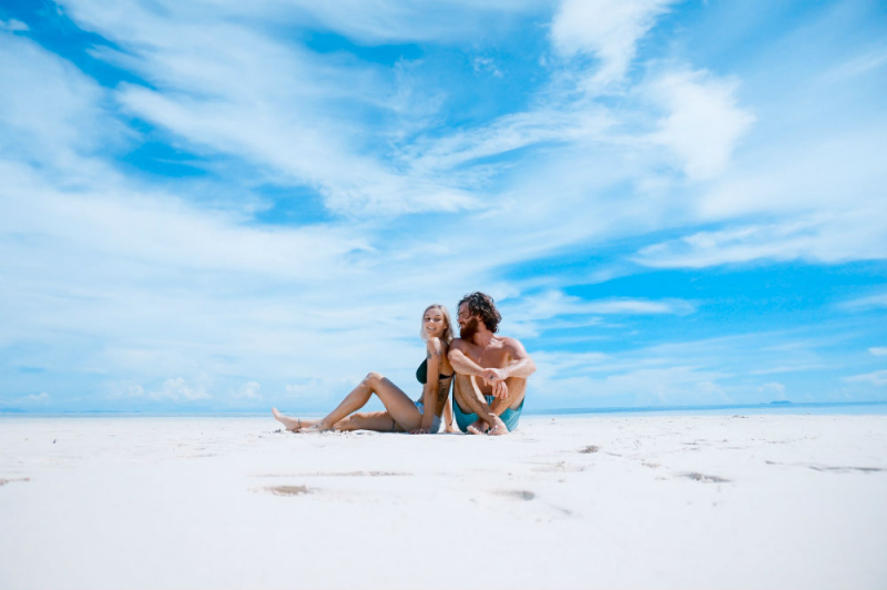
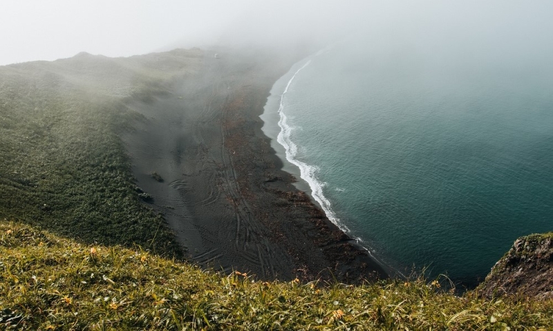
Acquaintance with the distant island began with this article. You may have already admired the majestic headlands, picturesque bays and beaches, sharp cliffs and remnants of Japanese heritage, but that’s not all. Photographer Andrei Shelkova, who grew up on Sakhalin, continues to show the beauty of the island region, talks about local dishes and goes to the End of the World to touch the Pacific Ocean. In the second selection you will find several more Sakhalin places that deserve attention.
Long road to the Far East
The easiest way to get from Moscow is by plane to Yuzhno-Sakhalinsk. Ticket prices start from 25,000 rubles* round trip with 23 kg luggage. I would advise going to the island in August as this is the best time in terms of weather. From the capital on these dates there are direct flights three times a day: at 17:05, 20:20 and 23:05. Travel time is about 8 hours.
In Yuzhno-Sakhalinsk you can relax, take a walk and recover after a long flight, and then go explore the island. The city also has several interesting places, and I’ll tell you about one.
Where to stay
Mini-hotel “Islander” from 1,000 rubles per night*;
Two-star hotel “Youth” at the foot of the mountain from 4,000 rubles per night*;
Four-star Mega Palace Hotel from 8,900 rubles per night*.
Local History Museum

Author: Andrey Shelkova
Coordinates: 46.959167° N 142.74444° E
Working hours: closed on Monday, Tuesday to Sunday from 10:00 to 18:00, except Saturday , then the museum is open from 10:00 to 20:00.
How to get there
The museum is located in the city center, so there will be no problems finding it. What makes it unique is not only the collection, but also the building itself in which it is located. The only thing not only on Sakhalin, but throughout the country. It was built by the Japanese in 1937 in the “teikan” style, which translates as “Imperial Crown” and reflects the entire appearance of the building. One might think that the museum is not even 100 years old, but this is not entirely true. The first collections began to be collected already in 1896, but due to the complex history of the island and relations with Japan, the final form, namely the regional museum of local history in the city of Yuzhno-Sakhalinsk, came only in 1946.
Even those who don’t like going to museums will like this place. After all, in a small area you can not only study the history of the island region, but also simply have a pleasant time talking or reading a book under the shade of trees. Just a good activity for the evening before long trips.
Turquoise lakes
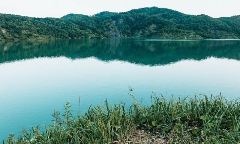
Author: Andrey Shelkovoy
Coordinates: 46.360019865671 s. w. 143.47071647644 c. d.
How to get there
Unfortunately, there are not many places on Sakhalin that can be reached by public transport. Therefore, I advise you to start preparing in advance and, before the trip, find either a guide or a car with a driver who will take you to the point.
The unusual color of these lakes is captivating. In the last century, coal mines were located here, their development continued until 2005. Then the remaining quarries were gradually filled with groundwater and rainwater, and the sulfites in the composition gave them unusual shades. The brightest of several lakes is called Turquoise.
Swimming in these places is prohibited, but nevertheless, in warm weather the entire shore is busy with tourists. Therefore, I advise you to come here early for several reasons. Firstly, there are no crowds of people here in the morning, so you will be able to take bright photos with the lake in the background. And don’t be upset if you don’t get sunny weather, even in cloudy times the color is still mesmerizing.
A little life hack: go up to the eastern shore of the lake, one of the best views opens up from there.
Turquoise lakes are just an intermediate point on the way to our next location.
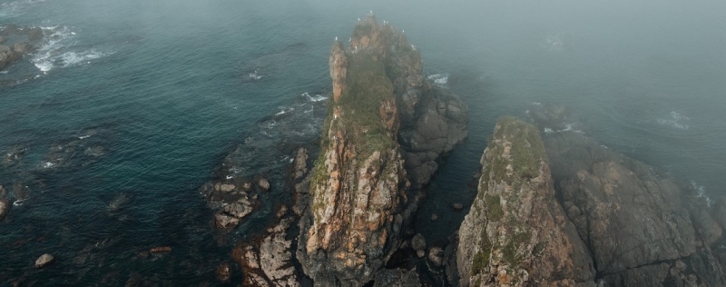
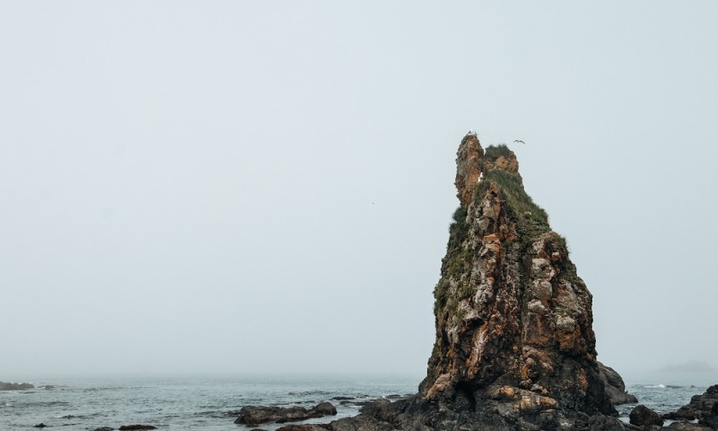
Cape Eustathia
Author: Andrey Shelkovoy
Coordinates: 46.299182457089 N. 143.56337070465 E
How to get there. By SUV or as part of a tour group.
From the lakes to the cape there will be about 15 km of not the most pleasant dirt road. But for Sakhalin this is business as usual. It’s surprising that in such remote places you can find both a lifted, powerful SUV and an ordinary Japanese sedan from the 90s. It all depends on the weather, precipitation and the skill (luck) of the driver.
At one time, we walked this route in an unusual way. By car, a friend and I drove to the lakes, took mountain bikes out of the trunk and then pedaled them to the cape. If memory serves, the journey one way took about two hours, since we had to barely climb countless hills.
For me, Cape Eustathia is one of my personal top locations. Yes, it’s small, but it’s all about shape and variety. If you look at it from a bird’s eye view, it somewhat resembles a hammer, where the handle is a relatively narrow isthmus connecting the cape to the island. What is the diversity? There are a huge number of places for photographs: there are green slopes, high cliffs and a rocky coastline. And that’s just part of it. Plus, if you climb to the highest point of the cape, you can seem to look at the island from the outside.
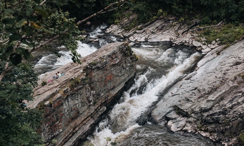
Bykovsky rapids
Author: Andrey Shelkovoy
Coordinates: 47.337310405077 s. w. 142.51576423645 in. d.
How to get there. By any car or as part of an excursion group.
The former waterfall on the Krasnoyarsk River is now a system of several small cascades ending in a large threshold. It’s not obvious, but this form is man-made. In Soviet times, this section of the river was blown up so that salmon could safely ascend to the upper reaches to spawn. Therefore, from the stone ledges you can not only admire the raging river, but also cheer for the fish that are trying to overcome the current.
Immediately after the rapids there is a hole that people like to dive into in hot weather. Refreshing, but be careful – there are dangerous rocks and rocks underwater. By the way, about stones and rocks. On the banks of the river there are often fossilized remains of fauna – ammonites and the like. Therefore, if you want to bring a truly unique souvenir, you can spend time not only swimming in a cold mountain river. Moreover, another impressive river location awaits us.
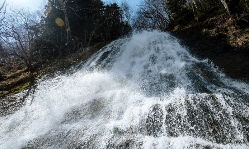
Klokovsky waterfall
Author: Andrey Shelkovoy
Coordinates: 48.447208599943 N 142.70616889 E
How to get there. By any car or as part of an excursion group.
The highest waterfall in the region and almost the most accessible. After all, it is located very close to the paved road leading to the north of the island. Therefore, you can get to the beginning of the trail by any car, and then you just have to walk a little (15-20 minutes, depending on the pace of walking).
The total height is 49 m, but only 35 of them can be seen, since the upper part is hidden behind trees and bushes. But believe me, even this height is breathtaking. Especially if you visit this place during the snow melting from April to June. It is then that the waterfall gains maximum power. And here’s another little life hack for cool photos: take a bright raincoat with you (preferably yellow). This way you can take photos close to the waterfall and stay dry. And in general, a raincoat and boots are very useful when traveling around Sakhalin.
Conclusion
Author: Andrey Shelkova
I will tell you what else useful things you should take with you to Sakhalin at the beginning of the next article, in which I will go to the island of Shikotan, located on the Kuril Islands. And after returning, we will go to get acquainted with the cuisine and places where you can buy something unusual (for example, sweets) as a gift for yourself and your loved ones. Rough road!
*Prices are current at the time of publication.