I am Andrey Shelkova, a photographer who was born and raised on Sakhalin, going to the eastern borders of our country to show another world of the island region. After two articles (part 1 and part 2) you already know what to see on Sakhalin, but the region does not end with one island. It also includes the Lesser and Greater Kuril ridges. These are 56 islands stretching from Kamchatka to the Japanese island of Hokkaido. Only four of them are inhabited: Paramushir, Kunashir, Iturup and Shikotan. I’ll tell you about the latter. It is the smallest among them, there are no bears on it, and it is here that Cape World’s End is located. But, to paraphrase Captain Barbossa’s quote: “It’s not only difficult to get to the End of the World, it’s also difficult to return.”
How to get there
To be allowed into the Kuril Islands, you will need a pass to the border zone. You can order it through the State Services portal, and it is better to take care of this in advance. In my case, it took a week to receive it. When filling out the form, you will need to indicate the settlements you are going to visit. For Shikotan these are the villages of Malokurilskoye and Krabozavodskoye. Don’t forget to take your pass with you, otherwise the border patrol will send you home.
We’ve dealt with a little bureaucracy, now let’s move on to logistics. The entire journey is divided into two parts – air and sea. Yes, yes, if you have seasickness, then stock up on medicine. The road ahead is long.
First you have to get to the city of Yuzhno-Sakhalinsk. There are direct flights from Moscow, the cost of round-trip tickets with luggage starts from 25,000 rubles*. The best time to visit in terms of weather is August. On these dates, direct flights depart from the capital three times a day: at 17:05, 20:20 and 23:05. Travel time is about 8 hours.
After this, prepare for a sea voyage from the city of Korsakov lasting at least 22 hours. Depending on the route, the journey can take 30 hours. You can get from Yuzhno-Sakhalinsk to Korsakov by taxi or regular bus. Ferry tickets are sold on the Sakhpasflot website. In August, the flight operates three times a week: Tuesday, Thursday and Saturday. At the time of writing, two ships sail along the route – “Admiral Nevelskoy” and “Pavel Leonov”. There are not many amenities on them: part of the deck for smoking, part of the deck with an observation deck, a cafe. I saw only third category seats for sale (through the website). This is a compartment for four people, larger in size than in trains. It has air conditioning, sockets, a decanter and glasses, a bathroom, TV, and cabinets with locks. If you like lower bunks, then take the second or fourth place in the cabin.
What to take with you
Despite the weather, be sure to take a raincoat and sunscreen with you. Fogs are common on the island, and the sun, which accidentally appears for just an hour, will quickly fry the skin to an unpleasant red hue. The weather on the islands is generally very difficult to predict. Even if it is hot during the day, it may suddenly become colder at night. I took thermal underwear with me and was right. In addition, +12 ℃ with wind and +12 without wind is like ice and fire. The difference is surprising, you need to be prepared for it.
On the island there are not many dangers among the fauna for humans. These are mainly ticks, and for especially curious people – foxes, which can bite. Put a nail puller in your first aid kit (there are different types, the device basically looks like a nail puller).
But flora can cause inconvenience. The culprit of all troubles is the red-leaved mustard plant, scientifically called toxicodendron. The name is telling. If you touch it, the skin becomes blistered, red, itchy, and the most annoying thing is that this does not go away for a very long time, and no effective treatment has yet been invented. Locals advise immersing the infected area of skin in sea water, but, fortunately, I did not have the chance to test this life hack. If you’re going to be walking through the bush, put on pants, tuck them into your socks (protection from ticks), and choose something with long sleeves on top.
Sea voyage
You need to arrive at the port of Korsakov 2 hours before departure. During this time, you will undergo inspection and register (mark in the log), then you will be taken to the ship and invited to board. My flight departed at 12:00 and went straight to Malokurilskoye.
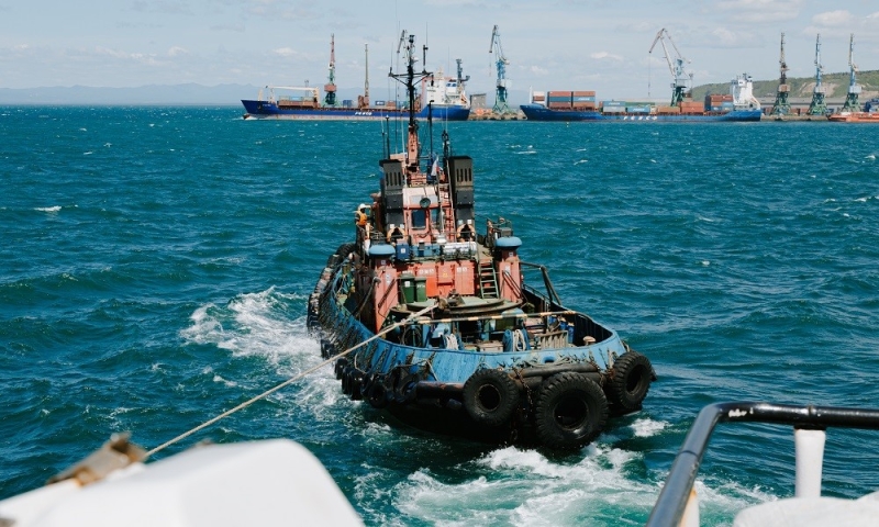
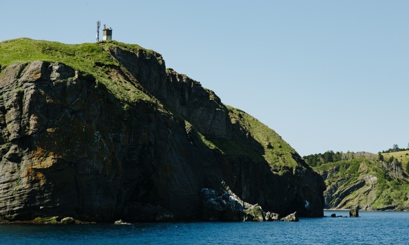
For experienced sea tourists, nothing interesting will happen at the beginning. Two tugboats will approach and take the ship out into open waters. Along the way, several beautiful places await you, and one of them is announced via loudspeaker after 3.5 hours. Aniva Lighthouse is one of the heroes of previous articles. Each time the ship passes at a different distance from it, but you can still see the Japanese heritage. The following species will be encountered in the morning. Fortunately, the rocking lulls me to sleep quite well, and I slept almost the entire time.
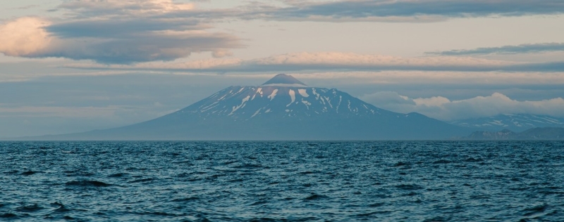
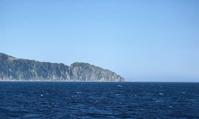
Volcano Tyatya
Shore of Iturup Island
At approximately 5:50 we pass between two islands of the Great Kuril ridge. From the starboard side you can admire the visiting card of Kunashir Island – the Tyatya volcano, and from the left – the coast of Iturup Island. In the dawn sun the spectacle is memorable.
The cafe opens three times a day at certain hours. There are various combo lunches, tea or coffee and, if you’re lucky, baked goods to choose from. The cost of a full set of combo lunch (first, second, salad and drink) is 700 rubles. Food – regular canteen dishes.
We got to the roadstead 2.5 hours before mooring. At this time, you can explore the coastal strip of Shikotan Island, return your bed linen and drink your morning coffee. Amazing places await us ahead.
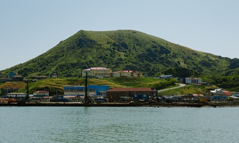
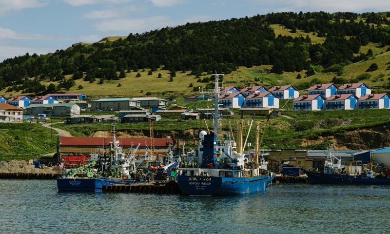
Malokurilskoe village
Coordinates: 43.870768, 146.827098
The first place you step on when you get off the ship. Small – according to the 2010 census, only 1,873 people live here. There is a takeaway cafe, a few shops, a coffee shop with Wi-Fi and 2-3 hotels. Prices in stores can be a little scary, due to the remoteness of the island. The cafe and coffee shop did not disappoint; we managed to drop by there a couple of times. But there is not much information on hotels; we lived in tents in one of the bays.
In general, most of the island is a nature reserve. I would advise you to look for a tour, since tourism in this place is slowly developing. This will solve the issues of accommodation, food and travel. My trip also included rides on SUP boards – an indescribable feeling. The camp was located in one of the most beautiful bays of the island. Let’s go there.
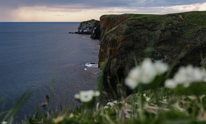
Bezymyannaya Bay
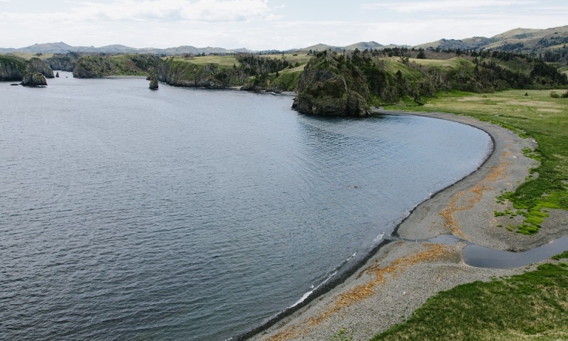
Coordinates: 43.813172, 146.881995
How to get there
If you are used to hiking, you can walk around the island in 3-4 days. SUVs are usually used to get around here, since there is not much smooth asphalt. In one place, part of the road was completely taken over by a river, so high ground clearance is indispensable.
The bay is not marked on maps, hence its name among the locals. Located near Cape Nepokorny, 11 km along a dirt road southeast of the village of Malokurilskoye. Despite the seemingly short distance, travel time by SUV can take about an hour.
But what views open up when you approach it. The bay is protected from large waves by several small islands on which seagulls nest. Once upon a time there was an ancient settlement of the Ainu (indigenous inhabitants), but now there is no trace left of it.
Two rivers flow into the bay, and there is even a small grotto in the rocks on the shore. An ideal place for SUP or diving. Just keep in mind that the water is cool even in summer, and don’t forget your neoprene suit.
While we got to the next point on the route and set up camp, the time was approaching sunset. This meant that we needed to hurry to the picturesque cape with an equally memorable name.
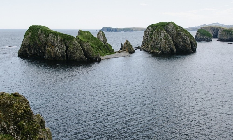
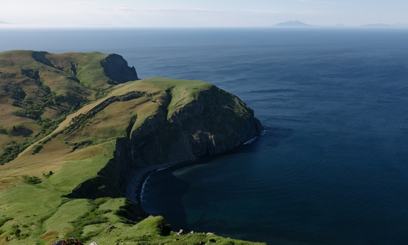
Cape World’s End
Coordinates: 43.846545, 146.913724
How to get there
In general, the tactics are the same as with the bay. Either on your own or with a guide in an SUV. The Edge of the World is located 4 km northeast of the bay.
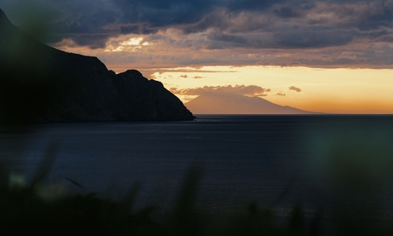
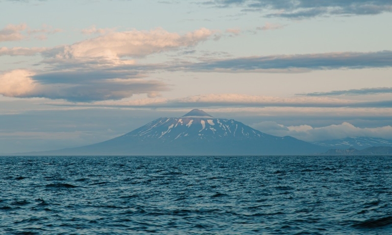
Shikotan Island in the foreground and Tyatya volcano (Kunashir Island) in the background
We made it in the midst of sunset, and we were lucky: the rain almost bypassed this place, not hiding from our view either the Tyatya volcano on Kunashir Island, or part of Iturup Island, or the lighthouse on Cape Crab. Now it was possible to officially say that I had been to the end of the world.
Cape World’s End itself is covered with short grass, and is framed by steep cliffs. Nearby there are also separate rocks with a small bird colony where seagulls and cormorants sit. There was little time to take photos – it was getting dark quickly. Therefore, after 20 minutes we went to the camp, have dinner and gain strength.
Mount Shikotan
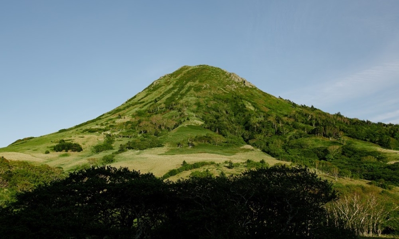
Coordinates: 43.870829, 146.857426
In the morning, part of the group had business in Malokurilskoye, so we went to the village and split up. My guide Alexey and I went to the highest point of the island – Mount Shikotan or, as the locals call it, 412th.
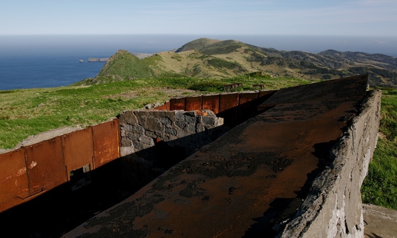
The climb can be done from both sides. We chose the one closer to the village. From it there is a calm dirt road to the foot, but the climb turned out to be quite steep, but short. The name 412 did not appear in vain; this is the height above sea level in meters. Although on some maps the mark is at 405 m, it is not so critical.
It is quite windy at the top, so take warm clothes with you. I was lucky with the weather and the panoramic view opened up in all directions. From this point you can see the Tyatyu volcano on Kunashir, the Berutarub volcano on Iturup, the village of Malokurilskoye, capes World’s End and Crab, and in general almost the entire island. After walking along the gentle peak of Mount Shikotan, we went down, from where we went to the camp, stopping at another cape along the way.
*Prices are current at the time of publication.